Rain Peak is a real place name, not a weather term. There is an 8,755-foot Rain Peak in Idaho's Lick Creek Range just north of McCall, and an unofficially named Rain Peak of about 13,100 feet in Colorado's Gore Range. Many people who search for Rain Peak are really asking where it rains the most, so this guide covers the rainiest places in the U.S. NOAA's wettest station data puts the strongest cluster in southeast Alaska, with Hawaii and Washington close behind. Which kind of wet you'll deal with depends on region: cold coastal rain in Alaska, warm tropical rain in Hawaii, or cool rainforest rain on the Olympic Peninsula. That split matters more than bragging rights, because a week of cold drizzle and muddy gear feels very different from a warm downpour that passes fast. For trip planning, long-term rainfall averages tell you a lot more about comfort than one wild storm ever could. The photo at the top of this guide shows mist rising through the Hoh Rain Forest in Olympic National Park, one of the wettest places in the lower 48 (photo: J. Preston / NPS).
Is Rain Peak a place? What the name means
Yes, Rain Peak is a place, and there is more than one. Idaho's Rain Peak is an 8,755-foot granite summit in the Lick Creek Range, part of the western Salmon River Mountains in the Payette National Forest near McCall. Colorado's Rain Peak is a roughly 13,100-foot summit in the Gore Range above Silverthorne. Its name is unofficial, a climbers' name that does not appear on federal maps. Neither peak is known for record rainfall, and they are mountaineering objectives, not weather stations.
This guide is about what most people searching for Rain Peak actually want to know: where in the U.S. it rains the most. For that, the right measure is average annual precipitation, not a one-day record or a local legend. NOAA Climate.gov frames wettest-place comparisons around long-term station normals, which keeps the ranking grounded in data.
That matters because the rainiest places in the US are not always the places with the most thunder, the most hurricane talk, or the most rainy days. They are the places that stack up the most water over a full year.
NOAA's U.S. Climate Normals are the federal standard for this kind of comparison. They use a 30-year period, so one weird wet year does not throw the whole picture off. For a traveler, that makes the data far more useful than a friend's story about one soaked weekend.
NOAA's wettest-station roundup also shows a clear pattern. The top stations cluster in southeast Alaska, Hawaii, and the Pacific Northwest, not the Gulf Coast or the Appalachians. In NOAA's table of annual normals, the top five are Yakutat, Alaska (155.12 inches), Ketchikan, Alaska (141.25 inches), Hilo, Hawaii (126.72 inches), Annette Island, Alaska (101.63 inches), and Quillayute, Washington (99.54 inches). If you're searching for the wettest place in America, you're usually comparing those regions more than hunting for one single name.
How NOAA measures the rainiest places

Image: NOAA
The NOAA map above shows satellite rainfall estimates around the globe, with the wettest areas in the darkest blue. Satellite data like this fills gaps between ground stations, but for ranking U.S. places by average yearly rain, NOAA's long-term station normals are still the standard.
The method is simple, and that is part of why it works. NOAA normals come from long-term weather station observations, then average out temperature and precipitation over time. That gives you a stable baseline for comparing one place to another.
Because the numbers smooth out very wet and very dry years, they are better for ranking the rainiest places in the US than anecdotal reports. A traveler might remember one dry week in Hilo or one sunny stop in Ketchikan, but the long view still shows those places as very wet.
NOAA's precipitation explainer uses station-based normals to map national wet and dry patterns. That gives this kind of article a fair method. It also explains why a famous destination may not top the list if the best-known visitor area is drier than a nearby station.
One thing a lot of travelers overlook is how local this can get. A single valley, island, or coastal site may be much wetter than a town just down the road. In real trip planning, station averages give you the baseline, but topography still decides whether one campground feels soaked while another feels manageable.
Why this matters for campers and road travelers
A place that gets more than 100 inches of precipitation each year creates a very different camping problem than a place that is just humid. According to Olympic National Park, the park's coast and western valleys get about 100 to 170 inches a year.
Persistent wet weather changes more than your jacket choice. It affects site selection, drying windows, condensation, trail wear, and how fast morale drops when every layer feels damp. Van build planning often starts here, with a simple question: how do you stay dry for three days in a row?
NEMO's condensation guide makes a key point that applies to tents and vans alike. In long wet spells, moisture management inside your shelter matters almost as much as the rain outside. That is why campers need a full system: shell layers, insulation that can handle damp air, dry storage, airflow, and smart campsite placement.
For a van build, that usually means vent fans, a heater, and a place for wet gear come before any cosmetic extras. For couples and families, repeated wet setup and teardown is often the point where a hard-sided shelter starts to make sense.
The rainiest places in the US by annual precipitation

Photo: Jennifer Kardiak / USDA Forest Service
Pictured above is a brown bear in the moss-covered rain forest of the Tongass National Forest, which covers much of southeast Alaska. That green, dripping forest is what the wettest cluster in the country looks like on the ground.
NOAA Climate.gov's wettest-station roundup highlights a tight group of very wet stations in southeast Alaska, plus Hilo in Hawaii and Quillayute in Washington. That regional pattern is the real story. The wettest place in America is tied to coastlines and mountains that catch ocean moisture.
Quillayute helps explain why the Olympic Peninsula shows up in so many wet-climate conversations. Olympic National Park says the park's west side and coastal valleys get about 100 to 170 inches of rain each year. That lines up with what travelers see on the ground: giant trees, mossy river valleys, and a lot of mud.
A ranked list works better when you add climate type. Southeast Alaska is a cool coastal storm belt. Hilo is tropical trade-wind rain. The Olympic Peninsula is cool maritime rainforest. Those labels help you picture what the wet actually feels like.
From a travel view, these places are worth the trouble because the rain builds the landscape people drive all that way to see. The same water that soaks camp chairs also feeds the forests, rivers, and lush green walls that make a place unforgettable.
Southeast Alaska: America’s wettest cluster
Southeast Alaska shows up again and again near the top of NOAA's station rankings, with places like Yakutat, Ketchikan, and Annette Island leading the pack. That concentration matters more than naming one winner. It shows a broad wet belt, not a fluke.
The setup is pretty clear. Pacific storm tracks push moisture into the coast, and coastal mountains help squeeze more rain out of that air. That is why the region stays so wet year after year.
For campers, southeast Alaska adds another layer of challenge because the rain is often cool. Cold rain raises the stakes fast. Couples traveling in a camper van usually care less about extra lounge space and more about heat, airflow, and where soaked jackets can drip without wrecking the whole cabin.
That is why heat and ventilation are the first things to plan for a shoulder-season trip north. After two straight days of rain, wet boots and jackets inside a small cabin make it clear that a place to hang layers and move air is not optional.
Hawaii and the Olympic Peninsula
Hilo, Hawaii ranks third in NOAA's table at 126.72 inches a year, which surprises people who think only Alaska or Washington belong on this list. NOAA points out that Hilo sits on the windward east side of a major summit in the tropics, where trade winds push moist air uphill. Tropical trade-wind rainfall can compete with the wettest mainland climates. The difference is how that rain feels once you step outside.
On the Olympic Peninsula, the Hoh and Quinault rain forests get about 140 to 167 inches of precipitation a year, or 12 to 14 feet, according to Olympic's rainforest page. Those numbers help explain the dense moss, conifers, and heavy understory growth that visitors remember.
The contrast is useful. Hawaii is warm and tropical. Olympic is cool, forested, and often harder to stay comfortable in for long stretches. In cool rainforest weather, warmth and moisture control usually matter more than square footage.
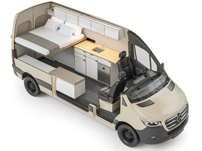
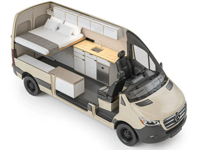
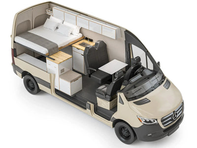
That is one reason many Pacific Northwest travelers focus on insulation, airflow, and quick-dry storage. If you are sorting layouts, pages like the DUO XL layout or family van conversions matter less for style than for how they handle muddy gear, damp towels, and the daily shuffle of wet layers.
Why the wettest place in America gets so much rain

Photo: Dave Turner / NPS
The Park Service photo above shows clouds banked in the valleys below the Olympic Mountains, the range that wrings rain out of Pacific storms before they reach the park's east side.
The same mountain wall that creates heavy rain on the west side also creates a rain shadow on the northeast side. So rainfall can swing hard over a short distance. That is useful for travelers because a short drive can change your whole camp experience.
USGS ties Olympic's ecology to geography, elevation, and precipitation gradients. That reinforces the big pattern seen across the country: the rainiest places in the US tend to sit where ocean moisture hits terrain that forces air upward.
Storm tracks matter too. Coastal zones open to repeated Pacific systems get fresh moisture again and again through much of the year. In real trip planning, moving to the lee side of a range can mean drying gear by lunch instead of never catching up.
Orographic lift and Pacific moisture
Olympic is a textbook case of orographic precipitation. Pacific moisture hits the Olympic Mountains, rises, cools, and condenses. The windward side gets drenched, while nearby lower or leeward areas get less.
This is why coastal mountain regions keep showing up in wettest-place rankings. A flat coast may be damp, but mountains are what often turn damp air into huge annual totals. The Olympic Peninsula makes that easy to see because very wet rainforest valleys sit fairly close to much drier areas.
USGS's ecology overview shows how those rainfall patterns shape the park itself. Rain is not just background weather there. It helps build the whole landscape.
For campers, this means windward coasts and mountain fronts should raise your expectations for saturated trails and slow drying. In a van, that is where a heater-plus-fan setup earns its keep. Foundation builds and more custom layouts often start with these core comfort systems for a reason.
Rain shadow and microclimates
Olympic's west side is famously wet, but the northeast side sits in a rain shadow and is much drier. That means one park can hold both rainforest travel and easier drying conditions. Broad forecasts do not always capture that.
Rain shadow effects are a good reminder that “rainiest region” does not mean every campground is equally wet. Microclimates matter. If comfort is the goal, many road travelers sleep in a drier town and day-trip into the wettest scenery.
Leave No Trace guidance matters even more in these zones because muddy trails and soft soils are easy to damage. Families especially tend to enjoy the rainforest more when they can come back to a dry sleeping setup at night.
What heavy rainfall creates in nature

Photo: NPS
Shown above is the Hall of Mosses trail in the Hoh Rain Forest, where the park reports about 140 to 167 inches of precipitation a year. The moss, ferns, and huge conifers are what that much rain builds over time.
Heavy rainfall does more than make a place soggy. It builds temperate rain forests, lush watersheds, and dense understory. Olympic National Park describes its west-side forests as temperate rain forests shaped by very high annual precipitation.
USGS adds that precipitation gradients, geography, and elevation are major drivers of biodiversity across Olympic. So the rainiest places in the US are not just weather trivia. They are ecologically rich systems shaped by water over time.
For a nature trip, that is the payoff. A dry, warm basecamp often lets people stay out longer and notice more, instead of racing back because their sleep clothes are already damp. Sprinter conversions and Transit conversions both make sense here because they give you a place to reset between wet hikes.
Temperate rainforests and biodiversity
Olympic's rain forests are one of the clearest mainland examples of what sustained precipitation can build over time. The park ties those forests directly to the heavy rainfall on its west side, and you can see it in the moss-covered logs and dripping branches along trails like the Hall of Mosses.
USGS reinforces that precipitation gradients drive ecological diversity across the park. In plain terms, rainfall helps decide where certain plants and habitats thrive. It shapes where life stacks up, not just how green a photo looks.
This is why the wettest place in America often overlaps with giant trees, epiphytes, moss-heavy wood, and salmon-bearing watersheds. For readers, the useful move is turning inches of rain into something you can picture: soaked bark, thick understory, loud rivers, and soft ground underfoot.
Those conditions are magical if your shelter and clothing are working. If they are not, the same beauty can turn into a slog.
Why wet landscapes feel different to travel through
High-precipitation places usually have fewer good drying windows. That changes how you pace a day outside. Even short hikes can feel heavier when every break, snack stop, and layer swap happens in wet air.
Wet trails and campsites are also easier to damage, which is why Leave No Trace's durable surface guidance matters so much. Camping away from water and staying on established routes helps protect saturated ground that scars easily.
Condensation becomes a bigger quality-of-life issue too. NEMO points out that warm, moist air meeting cool surfaces can soak a shelter from the inside. In a van, wet jackets, boots, and even dogs can push cabin humidity up fast.
That is why layout details matter so much in rainforest travel. A vent fan, heater, and a clear wet-gear zone often help more than one more decorative feature. If you want to sort those choices, customize your van around the climate you actually plan to use it in.
How to camp comfortably in a wet climate

Photo: R. McKenna / NPS
The photo above shows the beach below Kalaloch Campground on the Olympic coast on a gray March day. Coastal camps like this are beautiful, but they sit right in the path of Pacific storms, so drainage, dry storage, and ventilation matter from the first night.
Good wet-weather camping starts with site choice. REI advises avoiding low spots where water can pool and looking for better drainage. That sounds basic, but it is one of those small calls that can save a whole night.
Keeping one full set of clothing dry for camp and sleep is another core rule. Dry bags help protect sleep layers, insulation, and electronics from a single mistake spreading through all your gear. In cold rain, that reserve set can do more for comfort than any fancy gadget.
NEMO also stresses that condensation control depends on ventilation, campsite choice, and moisture management inside the shelter. A waterproof tent or van shell is only part of the job. You still need to move humid air out.
In a wet climate, heaters, roof ventilation, window coverings, and smart storage do more for comfort than cosmetic upgrades. If you are planning a van around shoulder-season trips, our process page shows how we sort those priorities, or you can contact us to talk it through.
Staying dry outside: campsite and clothing systems
Low ground is risky because rainwater can collect there even when a site looks flat. REI's advice to avoid depressions is simple and smart. A slightly higher patch with decent drainage often feels far better by morning.
Keep rain gear easy to grab, and separate dry clothing in waterproof storage. Dry bags are the backbone of that system because they protect sleep clothes, insulation layers, and electronics from cascading moisture problems. One soaked stuff sack can turn into a long night.
In cold rain, synthetic or wool layers are generally more forgiving when damp. Morale matters too. REI notes that managing comfort, food, and dryness helps prevent bad decisions during prolonged wet weather.
For van travelers, an awning helps, but it does not solve cabin humidity by itself. Families do best when everyone has a clear routine for wet shoes, towels, and jackets before that moisture spreads through the sleeping area.
Controlling condensation and interior moisture
Condensation happens when warm, moist air hits cooler surfaces. That means your shelter can feel wet inside even when it is not leaking and even when it is not raining. A lot of campers learn that the hard way.
Ventilation is one of the best tools you have because moving moist air out lowers interior humidity. Campsite choice matters too. Humid low areas and spots near standing water can make condensation worse before you even unzip the door.
Wet gear stored inside adds even more moisture load, so separating and managing soaked items helps. In camper vans, the physics are the same as in tents. Roof fans and heat used together work well because they warm the space while still pushing humid air out.
Insulation alone will not fix moisture. It helps, but real comfort comes from insulation, active ventilation, and habits for drying gear. If you are moving up from tent travel, that is one of the clearest gains a van gives you.
Leave No Trace in muddy, rain-soaked places
Wet climates ask more from your judgment. Leave No Trace recommends traveling and camping on durable surfaces, which matters even more when the ground is soft and muddy.
In puddled trails, stepping around the mud instead of through it can widen the tread and speed up erosion. Camping away from water matters too because saturated banks and shorelines are easy to damage. Wet places can tempt people to make a new dry patch, but that often scars vegetation fast.
Comfort and ethics are tied together here. Better planning usually means less campsite sprawl, fewer improvised fixes, and less wear on soft ground. Van travelers still need the same discipline, especially when established sites are muddy and a new pullout looks tempting.
The best wet-climate trips are the ones where you stay comfortable without asking the landscape to absorb the cost. That is true in a tent, and it is just as true in a van.
FAQ
Is Rain Peak a real place?
Yes. Rain Peak is the name of an 8,755-foot summit in the Lick Creek Range of Idaho's Payette National Forest, just north of McCall, and of an unofficially named peak of about 13,100 feet in Colorado's Gore Range. Neither is a record-setting rain spot. The wettest places in the U.S., by NOAA station data, are in southeast Alaska, Hilo in Hawaii, and the Olympic Peninsula in Washington.
What is the wettest place in America?
By NOAA station-based precipitation normals, the wettest U.S. locations cluster in southeast Alaska. Yakutat (155.12 inches a year), Ketchikan (141.25), and Annette Island (101.63) all rank in the top five of NOAA Climate.gov's wettest-station table. Hilo, Hawaii (126.72) and Quillayute, Washington (99.54) round out the top five, so the answer changes a bit depending on whether you mean one station or a broader region.
Are the rainiest places in the US all in the Pacific Northwest?
No. NOAA's wettest-station data points to three main clusters: southeast Alaska, Hawaii, and the Pacific Northwest. The Olympic Peninsula is one of the wettest mainland areas, but it is not the whole story. Tropical Hawaii and coastal Alaska belong in any serious list.
Why does the Olympic Peninsula get so much rain?
Olympic National Park says moist Pacific air gets forced upward by the Olympic Mountains. As that air rises, it cools and drops heavy precipitation through orographic lifting. The west side and coastal valleys get about 100 to 170 inches of rain each year, while the northeast side sits in a drier rain shadow.
How do you camp comfortably in a very wet climate?
Start with site choice and drainage. REI recommends avoiding low spots, keeping one full set of clothing dry for camp and sleep, and using dry bags to protect the gear you cannot afford to soak. NEMO adds that ventilation matters just as much, because condensation can wet out a shelter from the inside.
Is condensation a bigger problem than rain when camping?
It can be, especially on multi-day trips. NEMO explains that condensation forms when warm, moist interior air hits cooler surfaces, so a tent or van can feel wet even without leaks. In long rainy stretches, airflow and wet-gear control are often just as important as your rain shell.
Why does wet-climate travel push people toward camper vans?
Multi-day rain makes heat, ventilation, and a dry reset space much more valuable. For the Pacific Northwest or Alaska, heaters, vent fans, and a gear-drying routine are the first things to plan. Those systems make cold, wet trips far more comfortable than repeated tent setup in the same weather.
About the author

Electra Chronis
Head of Marketing
Electra leads marketing at The Vansmith. She writes across van life, camping and travel, from planning a trip to choosing and building the van that gets you there.
Read more about Electra